The magazine of the photo-essay

July 2018 back issue


“A free, really high quality photo-essay magazine. Fabulous!”
Stephen Fry. British actor, writer and film maker
by Mark Klett

El Camino del Diablo, or “Road of the Devil,” was one of the Southwest’s most
dangerous historic routes, a trail paralleling part of the current Arizona–Mexico
border and terminating at the Colorado River. The road was notorious for its
remoteness, extreme heat, and lack of water. The 1861 account of the route and
Arizona Territory by Raphael Pumpelly was published in 1869 in his book Across
America and Asia, and is one of the earliest on record.
I revisited El Camino to compare how the present-day experience relates to
Pumpelly’s narrative. It was impossible to find exactly where the young mining
engineer walked, rode, and spent his time, so these photographs do not respond to
his adventures in the form of a literal reference. Rather they reflect on a larger,
shared geography and its travelers.
Today, much of the region is patrolled by government agents and crisscrossed by air
and ground forces practicing for war. Immigrants and drug smugglers cross under the cover of darkness or through the
ruggedness of the terrain, hiding from detection. An extreme climate kills many who dare travel in hot weather. The
route has an occupied feel that registers a lengthy history of violence and surveillance along an increasingly militarized
border. There’s a legacy of human presence, sometimes tragedy, left only in traces. Yet as in Pumpelly’s day, El Camino
remains one of the most striking and wild regions of the Sonoran Desert. It is a place located at the compelling
intersection of transience, potential danger, and constant beauty.
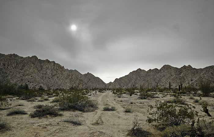
) Faint trail, granitic mountains near Raven Butte, 2013.
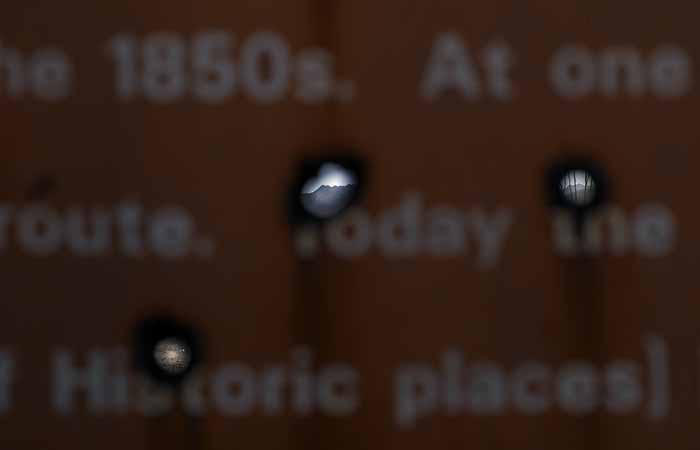
Sign explaining the history of El Camino del Diablo, with bullet holes, 2013.
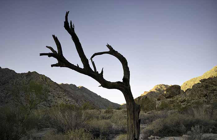
Trunk of ironwood tree sculpted by wind, 2015.

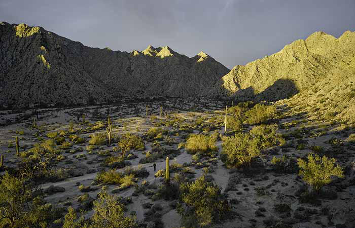
Approaching the Gila Moutains 2013.
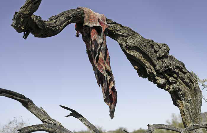
Blanket left in passing, 2013.
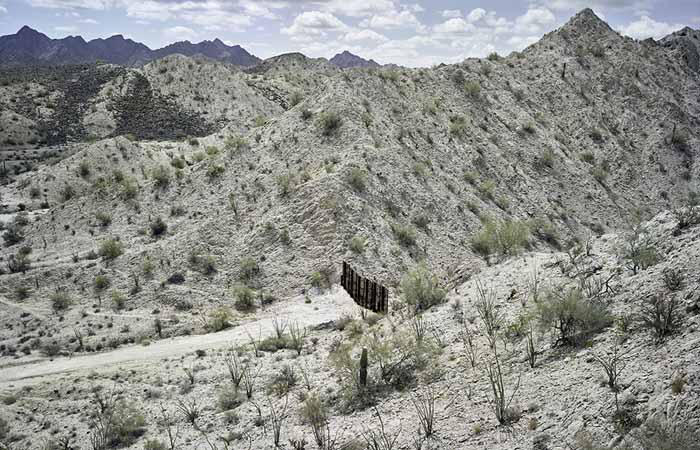
Fence separating the United States and Mexico, south of the Gila Mountains, 2015.
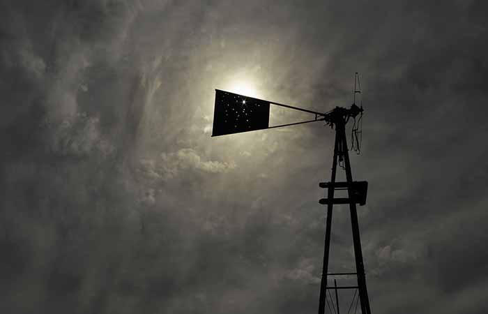
Abandoned windmill, Bates Well, Cabeza Prieta, 2013.
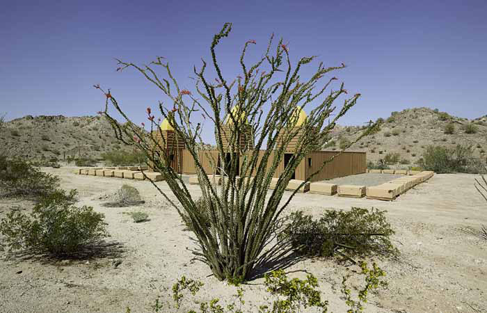
Ocotillo and mosque made from shipping containers, Marine training camp, Copper Mountains, 2013.
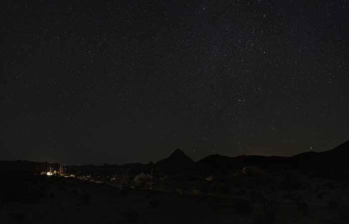
Standing before the sunrise at Raven Butte, 2014.
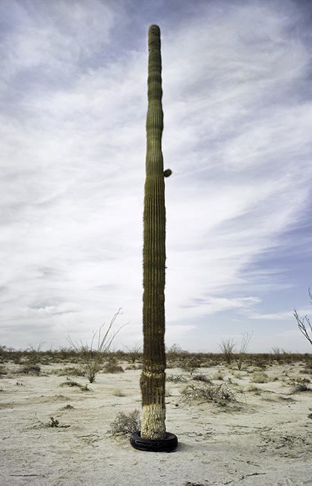
Saguaro with tire, Gila Mountains, 2013.
Border patrol “cutting sign” near midnight, El Camino del Diablo, 2013.
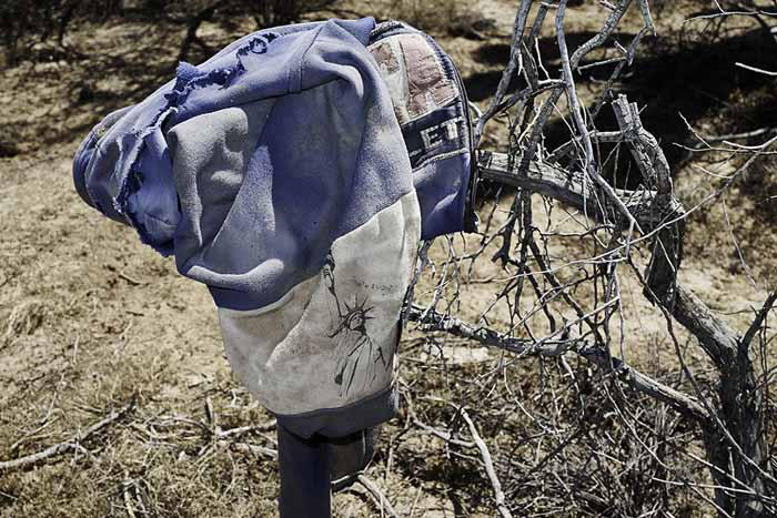
Jacket lined with the Statue of Liberty, found on migrant trail, 2014.
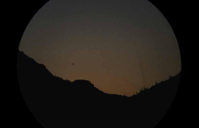
Hovering over smugglers: Border Patrol helicopter through binoculars at sunset, 2013.
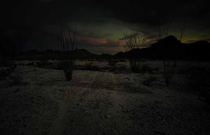
Slight track with red cloud at dusk, Copper Mountains, 2013.
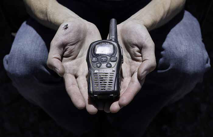
Smuggler’s radio found off Bates Well road, 2016.
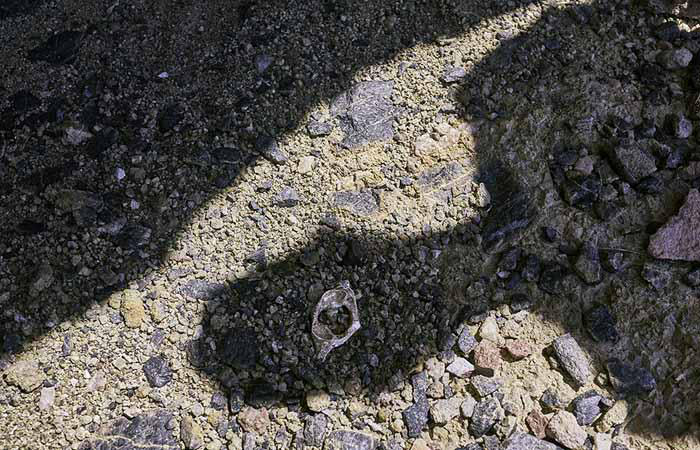
Human vertebrae, Sauceda Mountains, 2016.
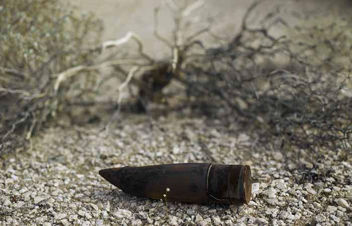
Unexploded ordinance, Goldwater Bombing Range, 2013.
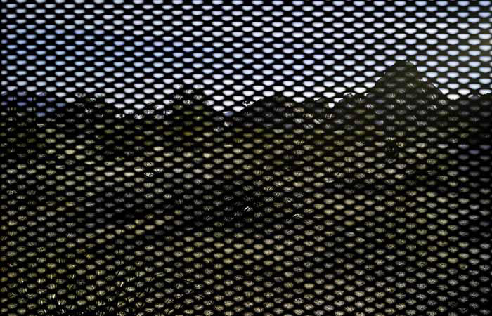
Bighorn sheep through the border fence, looking into Mexico, 2015.
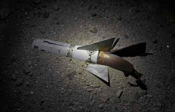
Sidewinder missile, Goldwater Bombing Range, 2014.
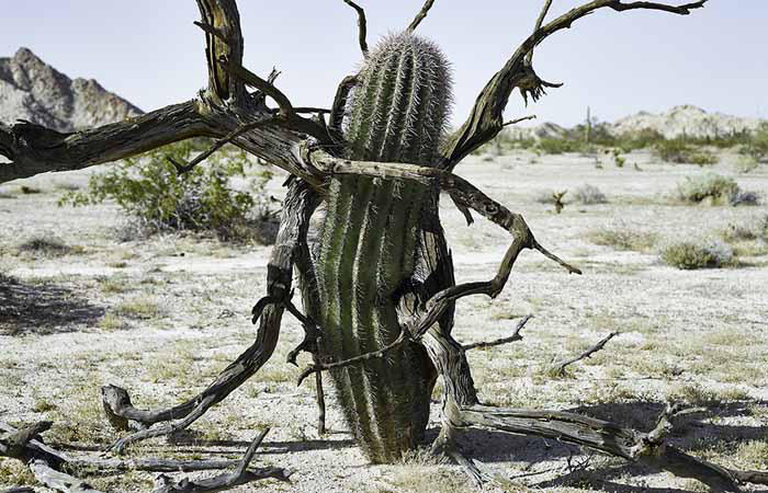
Saguaro gripped by its dead nurse tree, Gila Mountains, 2015.